- Saving staff months of work each year
- Eliminating plan review errors
- Ensuring citizens, staff, and developers always have access to the most current zoning resources
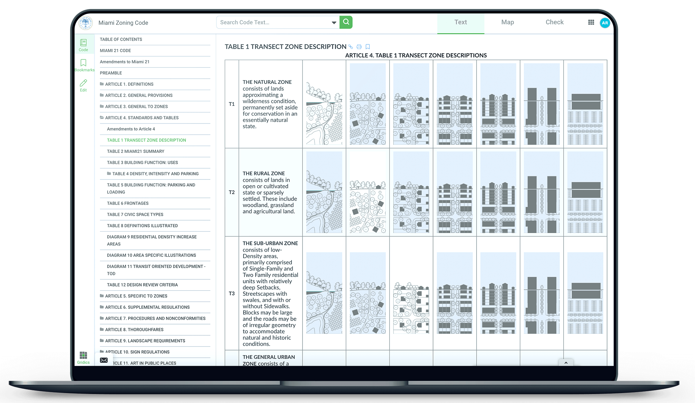
- Integrating zoning information across text, maps, and citizen self-service tools
- Reducing zoning management expenses
- Making it easy to embed tables, charts, and graphics within code text documents
Archives: Case Studies
Case Studies
Gridics Product Spotlight – MuniMap: City of Fort Lauderdale, FL
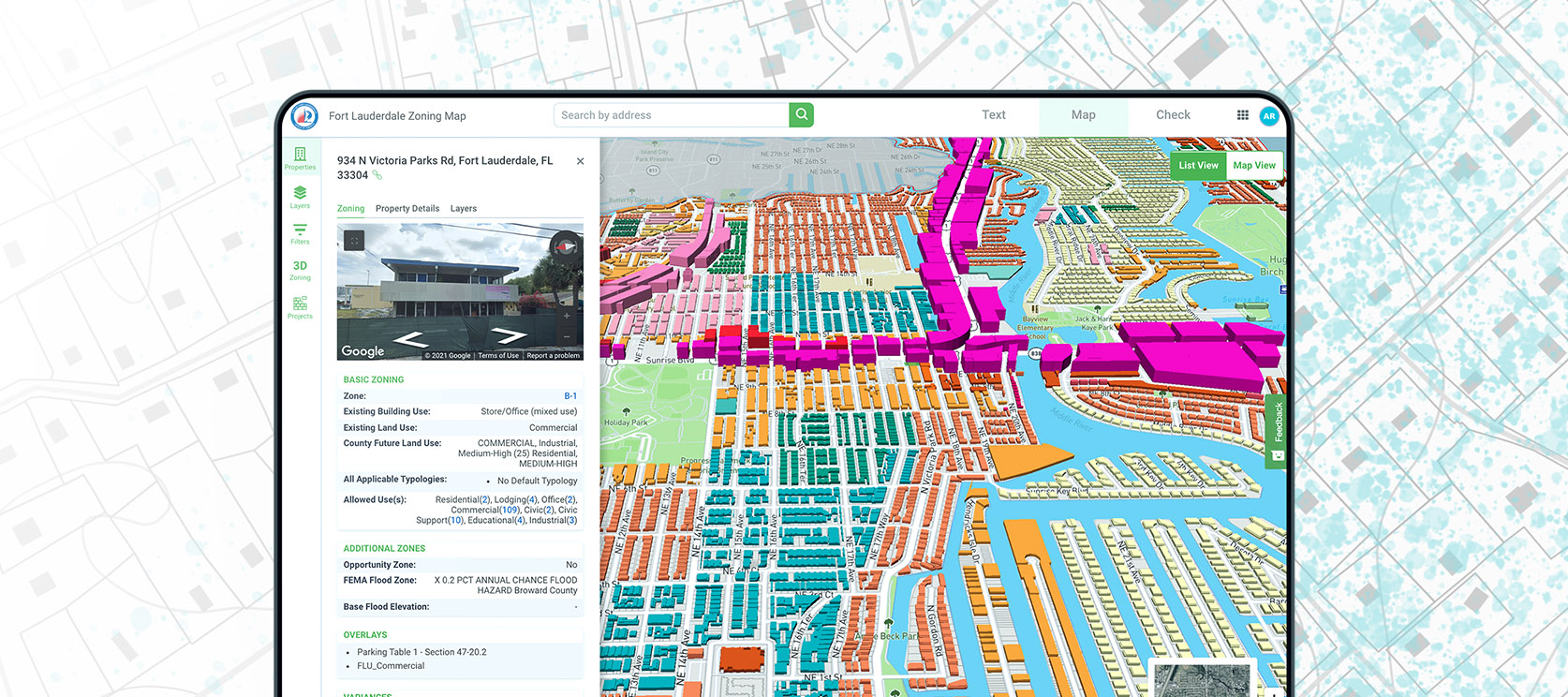
- Providing click-button access to development capacity data for any parcel
- Giving staff/stakeholders the ability to test zoning changes in real-time 3D
- Improving zoning transparency and remote access to data
- Encouraging new development and streamlining the development review process
- Visualizing the city’s future skyline in 3D
- Decreasing front counter zoning inquiries + reducing zoning management expenses
Gridics Product Spotlight – ZoneCheck: City of Hollywood, FL
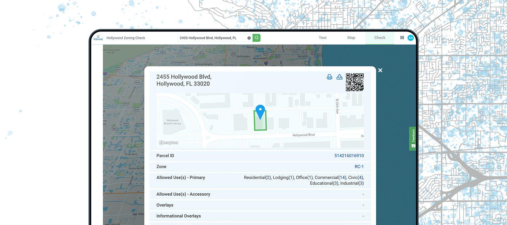
- Decreasing front counter zoning inquiries
- Improving zoning transparency
- Giving staff and citizens access to robust zoning data on any device at any time
- Bolstering “Smart City” initiatives and virtualization
- Streamlining staff efficiency and reducing zoning management expenses
- Encouraging development by making it easy to understand parcel-specific regulations
- Integrating zoning information across text, maps, and citizen self-service tools
Infrastructure Capacity & Demand: Millions of Dollars Saved Through Proprietary Development Analysis
The City of Miami and Miami Downtown Development Authority (DDA) commissioned this study to model the maximum development capacity by-right of the Downtown Historic Area based upon the Miami 21 zoning regulations and allowances.
The ultimate goal of the project is to identify parcels and assemblages most suitable for development and then calculate future infrastructure demand (electricity, water, sewer) given this projected development capacity.
Use of ZoneIQ
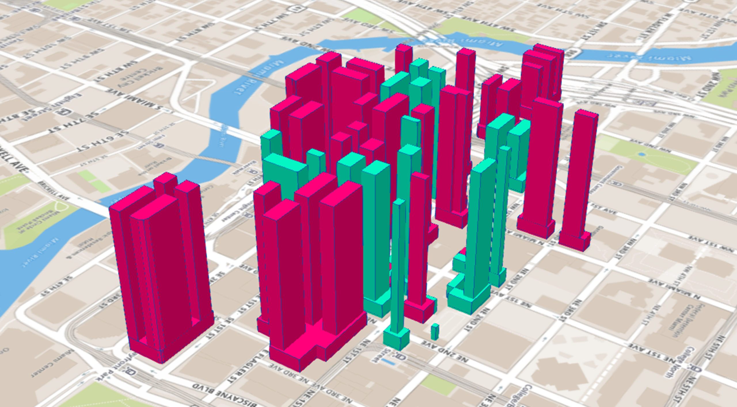
The Gridics team modeled the as-of-right development potential of 600 parcels (including historic properties with TDRs) showing mixed-use square footage, gross buildable area, parking, and more.
All 600 parcels can be visualized with the click of a mouse in our 3D zoning application, ZoneIQ.
Results
This study will likely save the City of Miami and utility companies millions of dollars. By planning for future development in advance, public and private stakeholders are able to put the necessary infrastructure in place now while road improvement projects are already underway. Our analysis will prevent the hassle and financial burden of tearing-up roads down the line to accommodate the infrastructure demand based on new developments. Please navigate here to download the full report: https://discover.gridics.com/flaglerstudy
TOD: Examining Development Potential Within Proposed Train Station Area Sheds
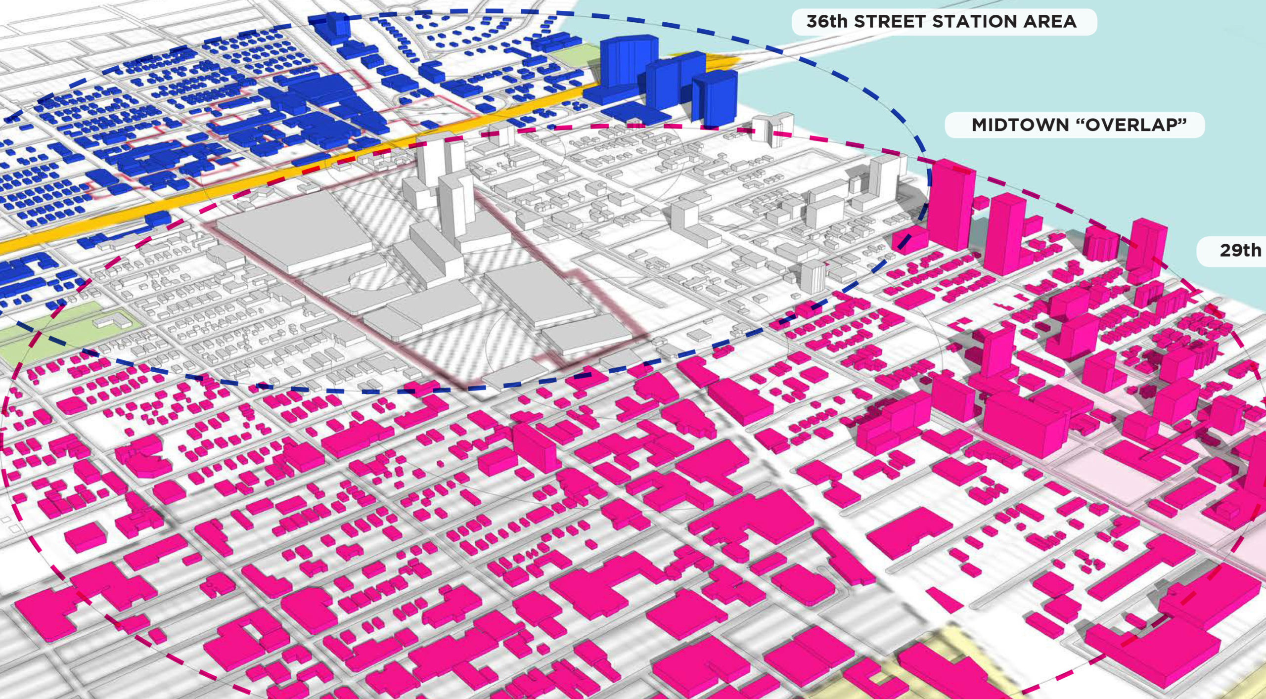
The Wynwood Business Improvement District (BID) in Miami, FL commissioned this study to identify and address the future mobility needs of the Wynwood/Midtown/Edgewater district. The intent of the study was to explore development capacity within two potential Transit Station Area sheds (areas within a 1⁄2 mile radius of a transit station) to help identify possible transit station locations along the existing FECI Corridor near Midtown Miami.
Use of ZoneIQ
In conjunction with renowned planning firm, Garcia-Pons + Associates, the Gridics team modeled over 200,000,000 gsf of max buildable area in 3D across both proposed transit sites. Examples of feasibility studies from our application can be seen on the right.
Results
Our data and modeling confirmed a 50% higher potential development capacity near the proposed 29th Street Station Area as compared to the 36th Street Station Area.
Rezoning: Proposing & Modeling Zoning Code Changes for a Growing Suburban Municipality
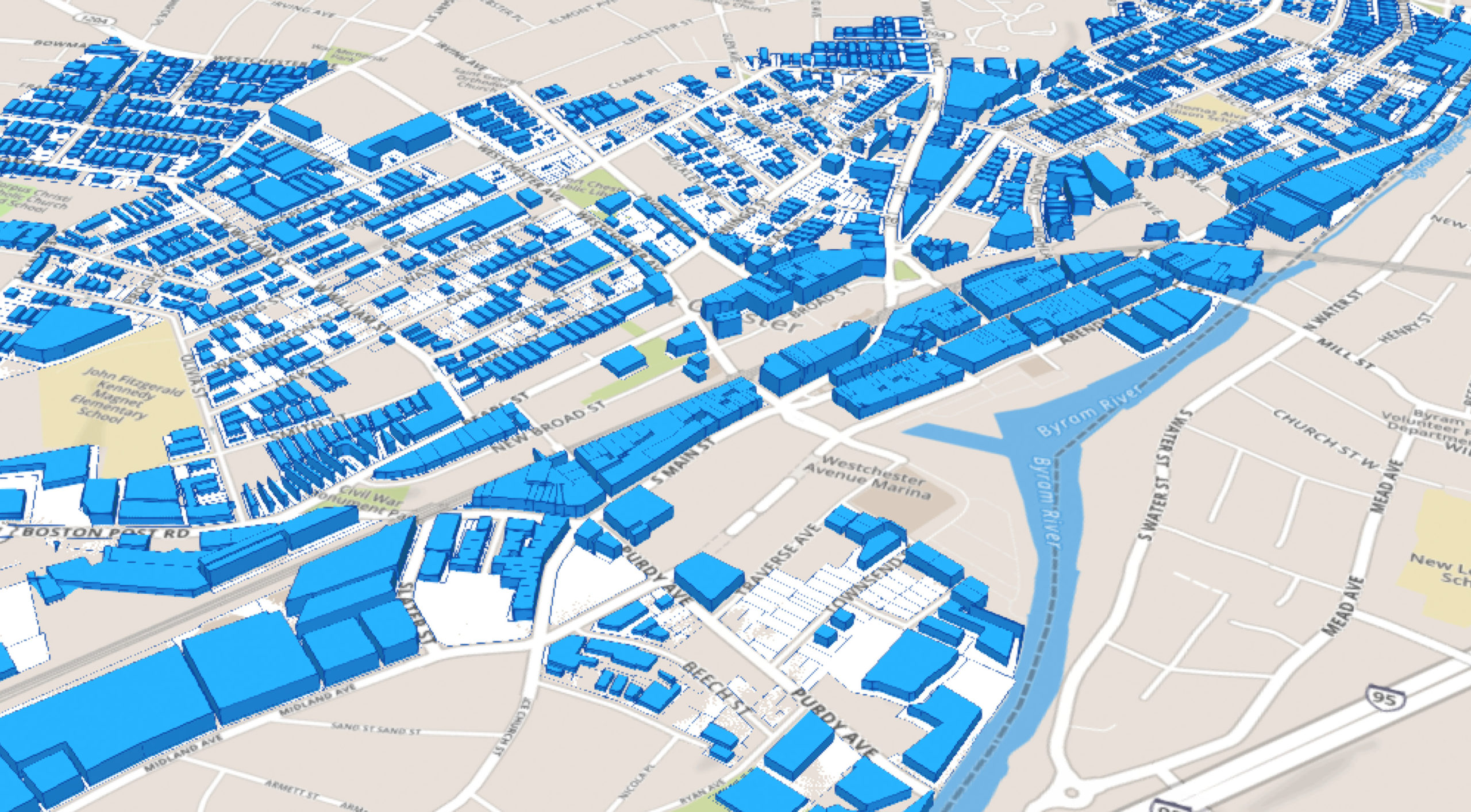
The Village of Port Chester, NY commissioned this study to analyze its existing zoning code, propose modifications, understand potential growth, and visualize as-of-right development allowances. Port Chester has experienced a boom in commercial and residential real estate over the past few years. Amending its zoning code was the next step in encouraging high-density development around the train station and waterfront.
Use of ZoneIQ
From viewing max build-out to manipulating code changes, running future growth scenarios, and illustrating amendments for municipal stakeholders, all data models were generated using the proprietary Gridics 3D zoning management engine.
Results
The Village of Port Chester approved and adopted the code changes proposed through this study and continues using our models to illustrate zoning changes in 3D. Our software facilitated the public engagement process through better visualization and transparency.
Amazon Headquarters 2 Case Study
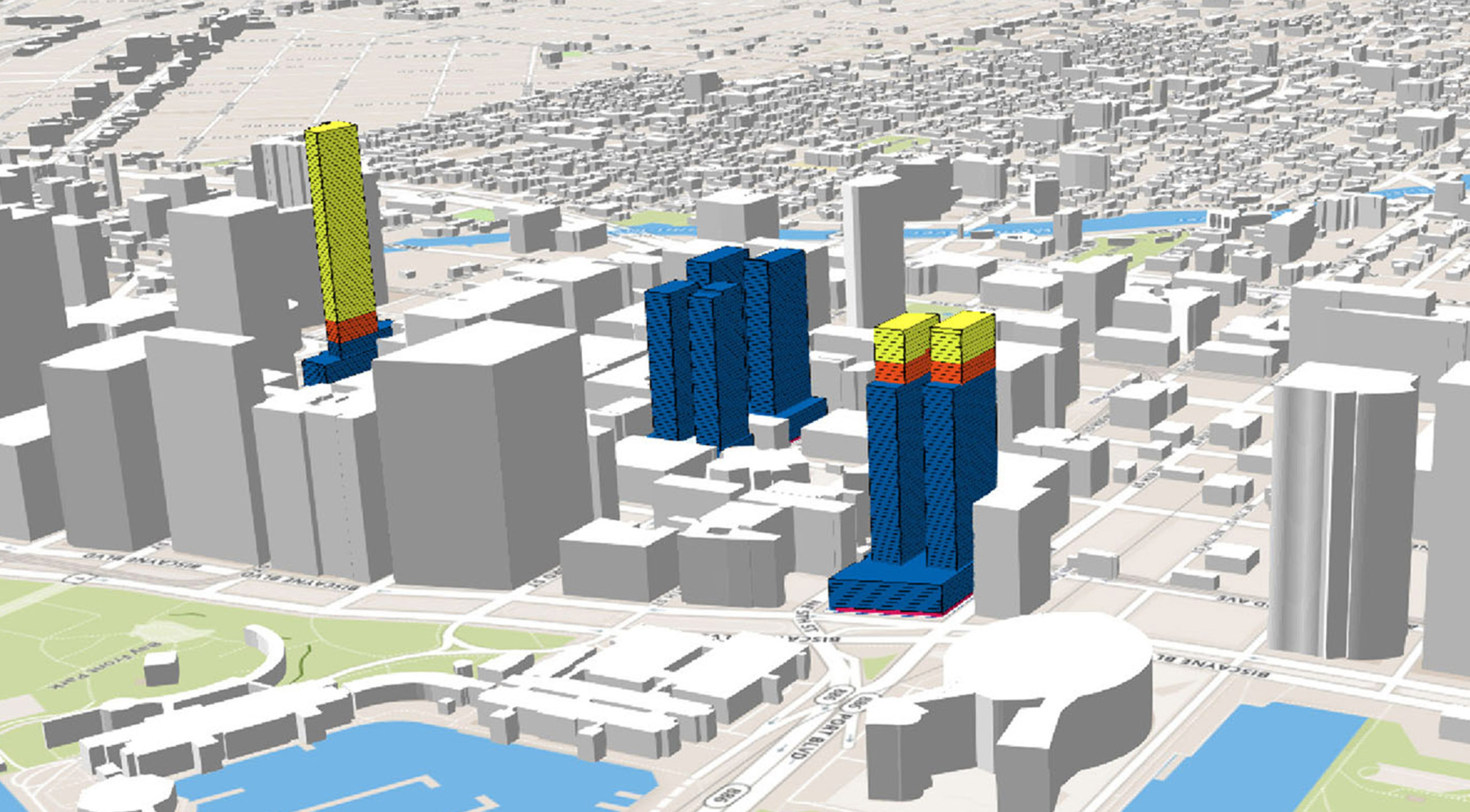
On September 7th, 2017, Amazon published a Request For Proposal (RFP) for cities interested in becoming the home of their next headquarters campus.
The RFP spells out specific quantitative real estate requirements and qualitative market requirements such as square footage needed, proximity to transportation and zoning conditions. Gridics’ ZoneIQ platform was designed to automate searches with variables exactly like these.
Download our summary case study showing how we used ZoneIQ to identify 150 available parcels in the City of Miami and narrow them down to the 6 most ideal sites for Amazon’s HQ2. Also, you can download the comprehensive feasibility report itself here.
To learn more about how we created this report, get in touch with our team to schedule a quick call: info@gridics.com
TOD: Analyzing Proposed Zoning Changes Bordering a New Transit Line
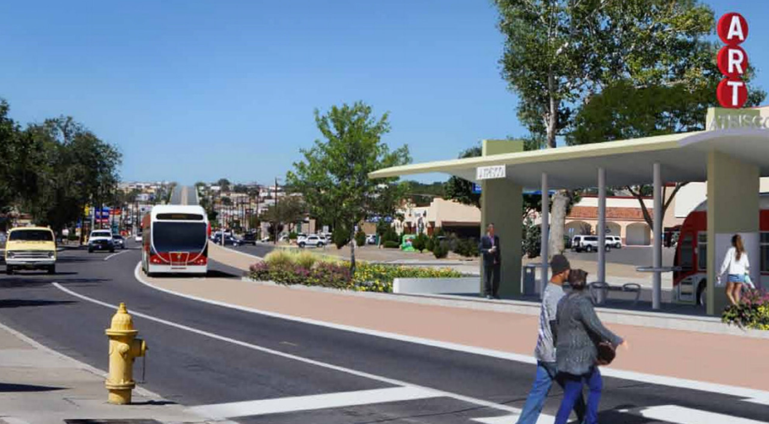
The City of Albuquerque needed to analyze proposed zoning code changes that would increase density around stations along a new BRT transit line. These changes are expected to be enacted as a new zoning regulation.
Use of ZoneIQ
The City of Albuquerque engaged Gridics, Urban 3, Crab Tree Group, DPZ, Placemakers, and CNT to provide recommendations and understand the development potential along the new transit line. Gridics’ ZoneIQ technology was used to analyze empty lots and understand the potential of proposed zoning changes.
ZoneIQ data was then used for tax and financial forecasting, to analyze potential infrastructure demand, and to model new incentives to encourage development. ZoneIQ identified unwanted outcomes with the new code in study, including non-compliance of empty parcels. Alternative solutions were tested with ZoneIQ in real-time at public workshops.
Results
Results are currently being used to create new legislation for the proposed TOD.
The Underline: Incentives for Pedestrian Friendly Frontages

The Underline is a 5+ mile proposed linear park underneath the Miami Metrorail elevated tracks with multiple properties abutting the project. Current zoning regulations treat these frontages as alleys/backside, with little pedestrian interaction. The goal of the Underline is to activate this dormant urban space and encourage pedestrian friendly development and active uses along the dense corridor.
Use of ZoneIQ
The Underline and the City of Miami engaged Gridics and its ZoneIQ platform to quickly understand the development impact of proposed setback changes along properties fronting the Metrorail path. Small changes were tested and proposed to encourage development of active uses along the park, to mitigate loss of development potential due to new setbacks, and provide incentives to property owners that ensure their support of the project.
Results
The Underline is partially funded and construction is underway. Proposed zoning changes are currently moving through the local legislature.