Request Demo

5 Benefits of Using MuniMap by Gridics

MuniMap Takes the Hassle Out of Zoning Visualization for Staff & Citizens

Register for Upcoming Webinar: webinars.gridics.com

It’s no secret that municipal zoning can be difficult to understand and navigate. Antiquated code text documents lead to hundreds—if not thousands— of citizen inquiries each year, cause headaches for staff to update, and ultimately impede new development.

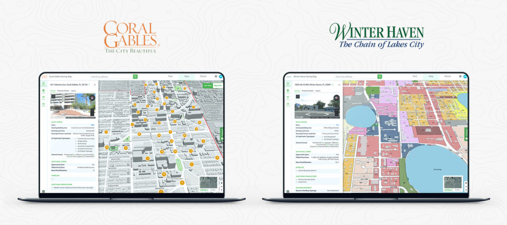
MuniMap by Gridics was designed with one simple question in mind…. What if we made it easy to visualize zoning and real estate data at the parcel-specific level?

MuniMap brings zoning and real estate data to life like never before.

How can you expect staff, citizens, stakeholders, developers, and council members to imagine the impact zoning rules in a static text document will have on the skyline of a city? The bottom line is…. You can’t. That’s exactly why we built MuniMap — to make zoning and real estate data interactive, accessible, and transparent for everyone, all the time.

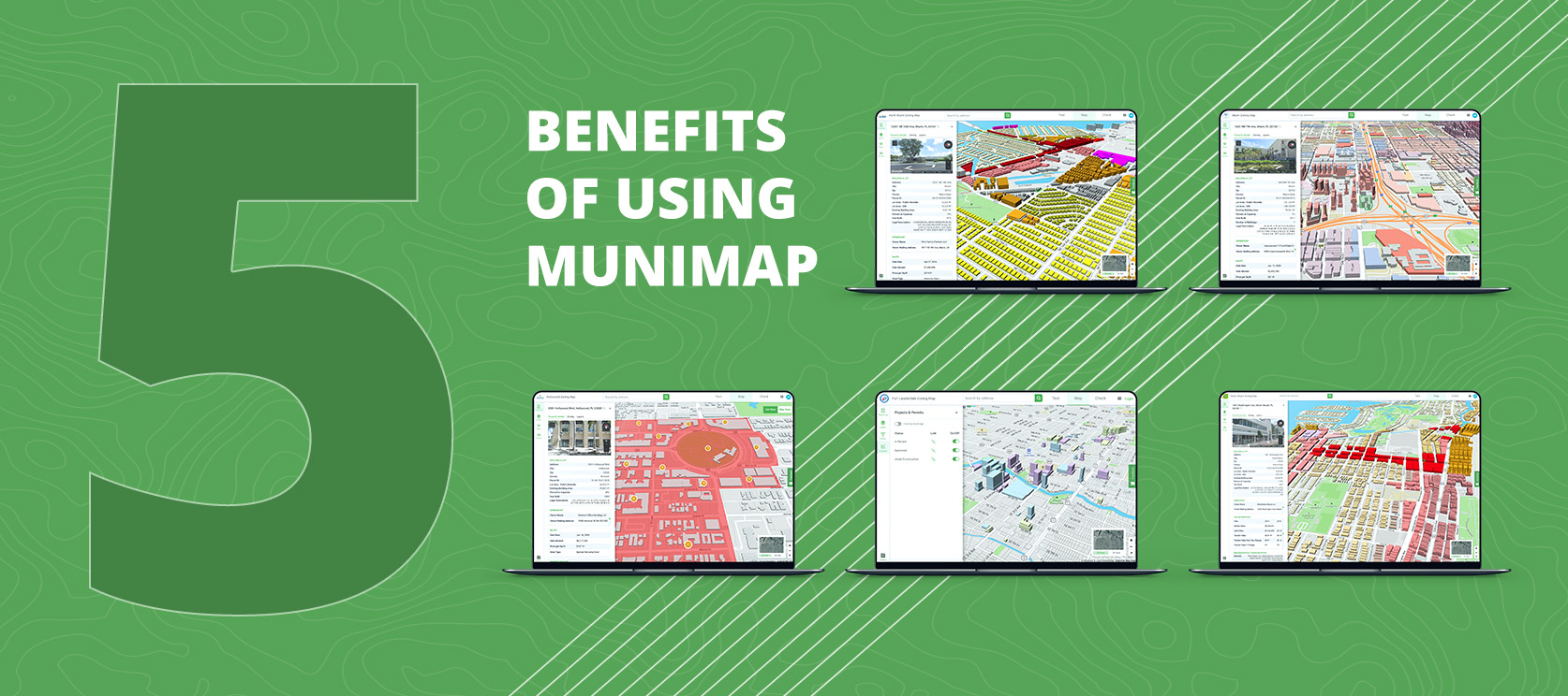
Municipalities across the country are leveraging MuniMap in unique ways, and here are just a few examples:

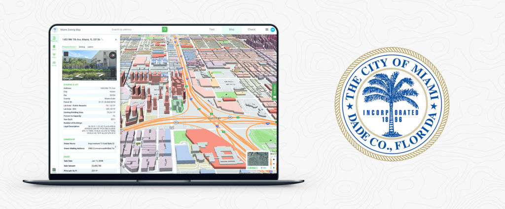
1) Visualizing by-right zoned development potential in 3D – City of Miami, FL

City of Miami 3D zoned development potential

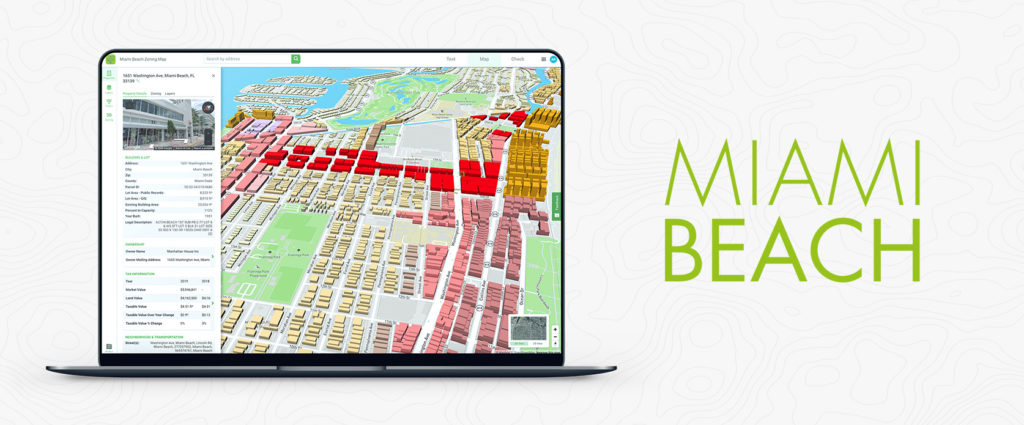
2) Leveraging the deepest parcel-level zoning data available to help reduce emails, phone calls, and front counter traffic – City of Miami Beach, FL

City of Miami Beach parcel-level zoning data

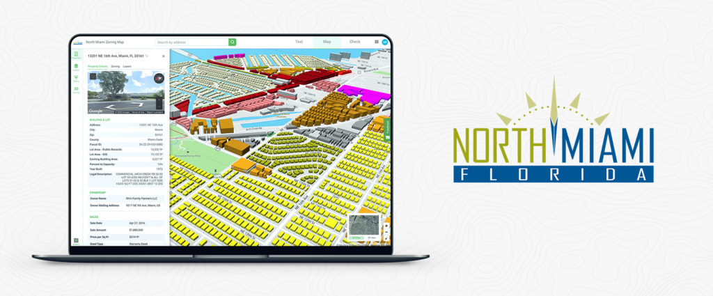
3) Encouraging and attracting new development – City of North Miami, FL

City of North Miami economic development

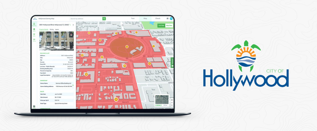
4) Giving citizens the ability to interact with zoning, GIS layers, and robust property filters – City of Hollywood, FL

City of Hollywood parcel-specific real estate data

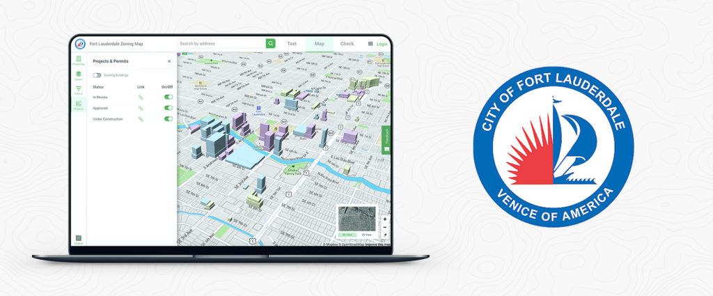
5) Showing the real-time status of current development projects – City of Fort Lauderdale, FL

City of Fort Lauderdale downtown development status

MuniMap delivers transparency for citizens, saves municipalities thousands of dollars each year on zoning management expenses, reduces low-value staff time, and improves collaboration with stakeholders and council members.

Join an upcoming webinar or contact our team today to learn how your municipality can be live on MuniMap in <6 weeks.

Coral Gables & Winter Haven Latest Florida Cities to Adopt Gridics Zoning Technology

Gridics’ Expansion Across Florida Continues as More & More Municipalities Look to Upgrade Zoning & Planning Technology

For Immediate Release: May 12, 2021

Register for Upcoming Webinar: webinars.gridics.com

Miami, FL — Gridics LLC announced partnerships with the City of Coral Gables, FL and City of Winter Haven, FL to adopt its next generation municipal zoning technology platform in an effort to reinforce smart city initiatives and upgrade zoning and planning technology. By partnering with Gridics, Coral Gables and Winter Haven will drive transparency for both developers and regular citizens by making it easier to visualize and interpret how zoning requirements apply to specific properties.

The Gridics 3D zoning platform utilizes the requirements in the zoning text with property records, parcel shapes, and modern mapping technology to allow cities to visualize and calculate development potential such as setbacks, allowable heights, and other dimensional requirements at the parcel-specific level. With this first-of-its-kind capability, Gridics will deliver Coral Gables and Winter Haven a new and improved 3D zoning map, a platform to directly update and publish their zoning code text in real-time, and a robust software for staff to streamline processes and better service citizens.

Smart City Officer Hiep Nguyen says, “The City of Winter Haven is committed to leveraging technology to keep our community safe, our residents engaged, the economy growing, and the quality of life improving. We believe that our partnership with Gridics will be pivotal in improving our operational efficiencies, enhancing government services, and streamlining the way in which the Planning Division serves our community.”

Ramon Trias, Director of Zoning & Planning, further explains, “Coral Gables has developed and implemented best practices for town planning since founder George Merrick’s team of professionals conceptualized the community in the 1920’s. The Zoning Code was adopted in 1930, and in 2021, Gridics partnered with city staff to update the structure and content and to enhance the experience of the user and the accuracy of the information provided to the public. The 2021 version of the Zoning Code contributes to a century of best practices that built Coral Gables’ quality of life and should promote excellence in design and sustainability into the future.”

As a complement to its technology offering, Gridics urban planners and architects will assist Coral Gables and Winter Haven staff as they conduct zoning code amendments and model the real-time impact of zoning changes on development potential. The combination of Gridics’ patented 3D zoning engine and tech-enabled professional services proves to be a natural fit for municipalities like Coral Gables and Winter Haven that are looking for ways to drive efficiency and deliver world-class citizen services.

“We are excited to add the City of Coral Gables and City of Winter Haven to the growing list of Florida cities adopting our platform, but more importantly, we look forward to partnering with staff to help support their mission to bring government and citizens together,” says Jason Doyle, CEO of Gridics. “At Gridics, our core mission is to do our part to make cities and communities better places to live, work and play. Zoning plays a foundational role in achieving that mission, so we set out to make zoning easier to visualize and understand.”

About Gridics: Gridics provides real estate data and software applications for cities and counties in the area of zoning and economic development. For more information, visit www.gridics.com.

MuniMap, Coral Gables & Winter Haven, 3D zoning technology