Bring Your Zoning to Life in Real-Time 3D
MuniMap makes zoning, development projects, infrastructure, & custom GIS layers dynamic.
Everything is better in real-time 3D.
Explore MuniMapInterested in How Gridics Can Help?
Our team is ready to help with both public & private sector zoning challenges
By Providing Your Email, You Agree to Our Privacy Policy
Trusted by Zoning Leaders
Since 2015, we’ve helped top municipalities & companies worldwide get more out of their zoning data.


Explore Our 3D Map in Your Browser Today
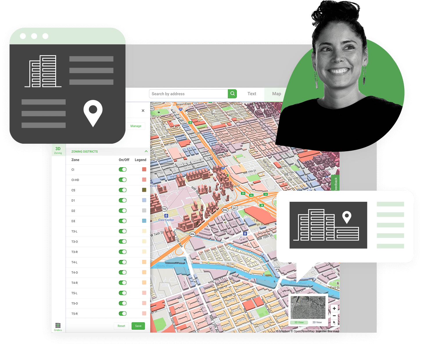
3D Interactive Zoning
Give staff, citizens, & stakeholders real-time access to a public-facing, 3D zoning map
Real-World Example: City of North Miami linking our 3D map to their main municipal website
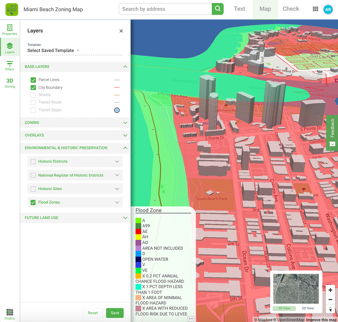
Custom GIS Layers
Apply custom data to our 3D interface such as energy usage, infrastructure demand, traffic, & more
Real-World Example: City of Miami Beach incorporating flood zone & sea level rise data

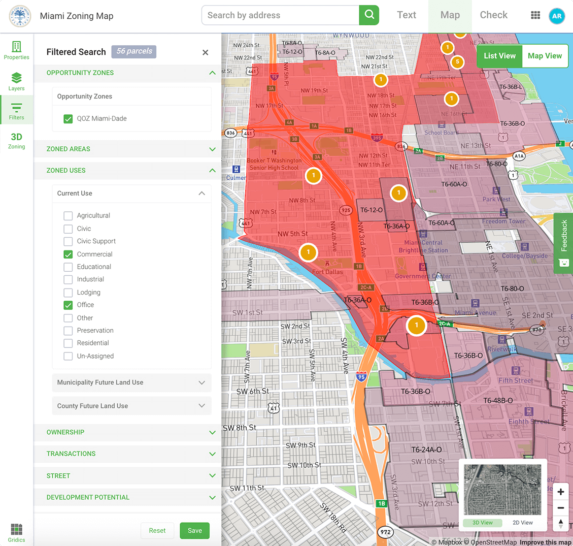
Economic Development
Utilize robust filters to identify & encourage new development
Real-World Example: City of Miami using our technology to find potential Amazon HQ2 sites
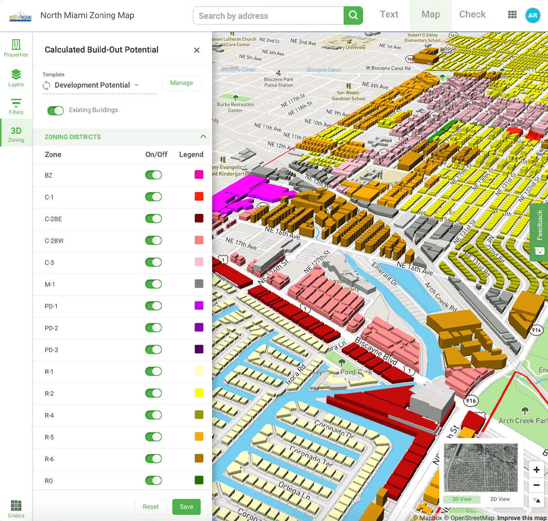
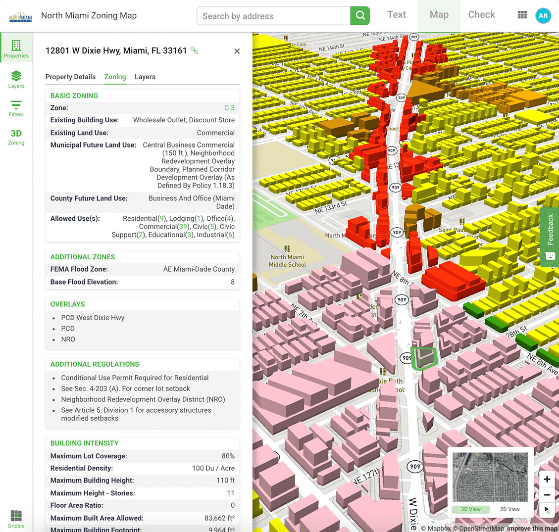
Deep Parcel-Level Zoning Data
Click on any property & see zoned development capacity, setbacks, lot attributes, & more
Real-World Example: City of North Miami streamlining front counter inquiries with click-button comprehensive zoning data
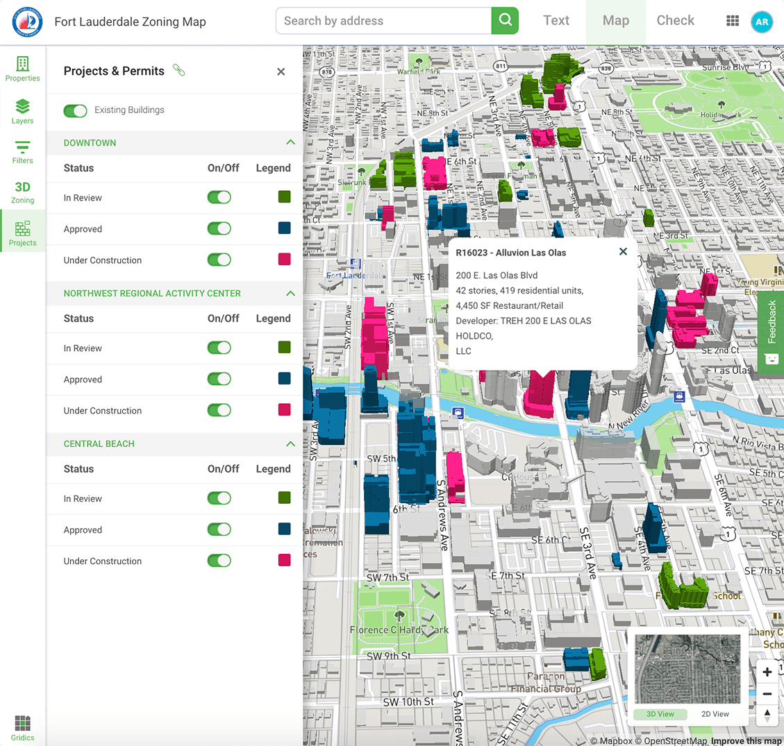
Permits & Projects
Visualize the status of pending, approved, & under construction development sites
Real-World Example:City of Fort Lauderdale showing 3D development status as part of their public-facing map
Interested in How Gridics Can Help Your City?
Let our team walk you through a personal demo