Municipalities large and small are turning to the Gridics platform to facilitate transparent development regulations, provide click-button, comprehensive real estate data, and help municipal staff conduct business safely through online services.
For Immediate Release: September 7, 2021
Register for Upcoming Webinar: webinars.gridics.com
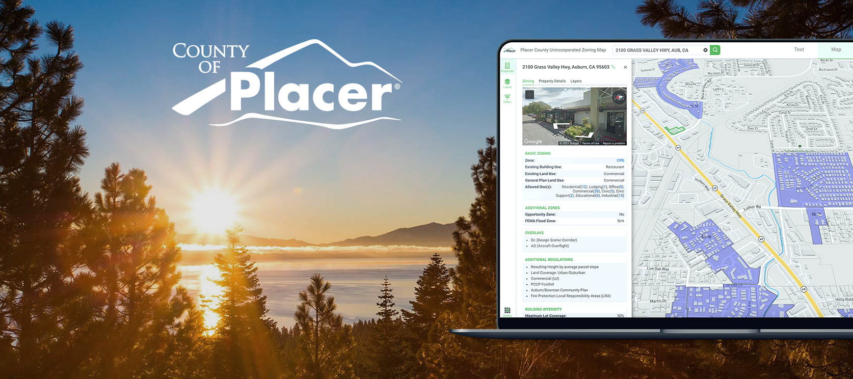
Auburn, CA — Gridics LLC today announced a partnership with the Community Development Resource Agency (CDRA) in Placer County, CA to adopt its integrated zoning management platform. Placer County will utilize all three Gridics applications in the cloud (ZoneCheck, CodeHUB, and MuniMap) to streamline planning, zoning, and land development and better serve its nearly 400,000 citizens.
As one of California’s fastest growing municipalities, Placer County is committed to leveraging smart city technology whenever possible to promote and manage sustainable development. Through Gridics’ interactive platform, the public can now understand what can be built and where in real-time based on the County Zoning Ordinances and Development Standards.
Steve Pedretti, Director of the Placer County CDRA says, “Gridics gives Placer County the ability to share with the public clearer and more precise parcel information on properties in the unincorporated area of the County. Placer County has wide-ranging land use characteristics from valley suburban to rural foothill properties, mountainous terrain, and world-class resorts near Lake Tahoe. Gridics’ dynamic platform provides easy to use access twenty four hours a day, seven days a week. It has never been easier to access property information in Placer County.”
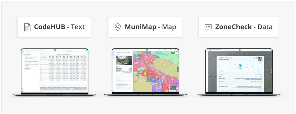
The Gridics platform delivers unique zoning and development allowance data for every property providing a unified zoning information portal allowing staff, citizens, developers, and municipal stakeholders to switch between dynamic zoning code text (CodeHUB), interactive 3D zoning and GIS layers (MuniMap), and user-friendly data tools (ZoneCheck).
“We are excited to partner with Placer County to digitize their zoning and real estate data,” explains Jason Doyle, CEO of Gridics. “Placer County came to us with the exact series of challenges Gridics was uniquely built to solve. Our patented engine provides municipalities with over 30 data points for every property including development capacity, allowed uses, density, and core zoning attributes which helps to streamline citizen services and provide a foundation for making smarter and faster data-driven decisions.”
Both Gridics and Placer County are on a mission to plan, develop, and build better communities. Through this partnership, citizens and municipal staff will be able to make more informed, data-driven decisions to positively shape the future of Placer County. The success of a community begins with smart zoning, and Gridics gives the power of parcel-level insights to everyone, accessible on any device.
About Gridics: Gridics provides real estate data and software applications for cities and counties in the area of zoning and economic development. For more information, visit www.gridics.com.