By recording ten years of Flickr photo geotags and drawing lines between them, Mapmaker Eric Fischer has used the Flickr API to create The Geotagger’s World Atlas, a beautiful map of the most photographed places in the world. Aside from comparing global cities (the map of London is a beauty), his map shows what Flickr users find most interesting about Miami through clusters of lines.
By recording ten years of Flickr photo geotags and drawing lines between them, Mapmaker Eric Fischer has used the Flickr API to create The Geotagger’s World Atlas, a beautiful map of the most photographed places in the world. Aside from comparing global cities (the map of London is a beauty), his map shows what Flickr users find most interesting about Miami through clusters of lines.
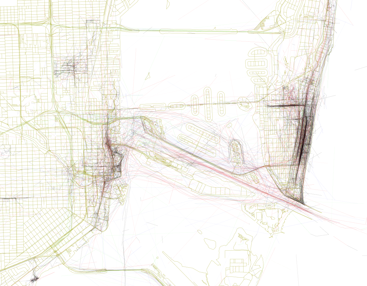
In a blog post, Fischer explains the importance of turning those geotags into lines and observing how they cluster on the map:
A cluster of geotagged photos is a good indicator of the interestingness of a place because it signifies that people went there in the first place, saw something worth taking a picture of, and put the extra effort into posting it online for others to appreciate. And a sequence of photos along a route is even more significant, because it indicates that someone sustained their interest over distance and time rather than taking one picture and turning back.
Miami’s biggest photo winners obviously Ocean Drive and Lincoln Road, two streets constantly overrun with photo-happy tourists. Another major presence on the map is a big red line (signifying someone traveling between 7 and 19 miles an hour) streaking down Government Cut and then disbursing out in the Atlantic. Miami is the biggest cruise ship port in the world, and of course cruisers love taking photos. Wynwood, Downtown Miami, and more specifically Biscayne Boulevard in front of the AmericanAirlines Arena all stand out very strongly (for comparison Marlins Park hardly registers). Lines cluster around scenic highlights such as Vizcaya, the Biltmore Hotel, and Downtown Coconut Grove.

Miami and Miami Beach. Map via Mapbox/Eric Fischer

South Beach. Map via Mapbox/Eric Fischer

Downtown Miami and Wynwood. Map via Mapbox/Eric Fischer

South Florida. Map via Mapbox/Eric Fischer